


 Shkruar nga Pamfleti
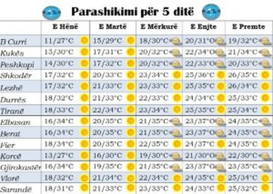
Finally, after several weeks of unstable weather, for the week ahead, our country will return to "normality"! This refers to the gradual penetration of the African Anticyclone first over Central Europe and then over the territory of our country.
In this way, for the whole week ahead, the weather is predicted to be clear throughout the territory and full of sunny hours.
However, in the mountainous reliefs in the east in the midday and afternoon hours, there will be a development of clouds but transitory which will be accompanied by short-term rains in the form of isolated thunderstorms.
For this week, it is worth noting the significant increase in temperatures, both in the minimum values, but mainly in the midday with values up to 36-37 degrees Celsius. Also, we should mention that starting from Wednesday, but mainly on Thursday and Friday, the real sensation of midday temperatures will be several degrees higher than the one measured in the meteorological cage due to the relatively high humidity in air.







Lini një Përgjigje