


 Shkruar nga Pamfleti
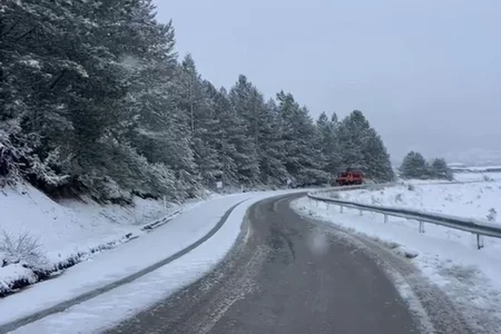
In mid-March, Albania is experiencing a return of cold weather, accompanied by low temperatures and snowfall, after a two-week period of typical spring conditions.
According to meteorologist Lajda Porja, in an interview for "Ora News", this situation is related to the penetration of polar air masses from Northern Europe towards the Balkans. Although it may be perceived as unusual, she emphasizes that the month of March has historically been humid and rich in precipitation.
In the past, there have also been cases of snowfall during the month of April, while climate change in recent decades has contributed to rising temperatures, making this return of cold weather seem more unusual.
"Yes, in fact the temperatures are quite low if we were to compare them to the normal values of March. If we were to make a comparison, is this something that has not happened? No, we have had cases where we have had snow even during the month of April."
If we were to make a comparison with previous years, around the '90s, March was very humid, with rain and snowfall, but without a doubt it seems something not very normal if we consider the last two or three decades where we have had quite high temperatures due to climate change.
After spending almost the first 15 days with typical high summer temperatures and no precipitation, the second 15 days were actually predicted to be somewhat more unstable.
In terms of climate, if we talk about normal conditions, the month of March should be relatively humid, meaning it is rich in precipitation.
However, this March is predicted to not have normal rainfall, but to be below the norm because even during these days, we have seen that rainfall has been scarce.
There has been snowfall because this cold polar mass has penetrated from Northern Europe towards mainly the Balkan Peninsula and a northern part of Greece.
Meanwhile, the rest of the European continent is facing clear weather and higher temperatures, if we're talking about Central Europe here as well.
It is predicted that today the precipitation will be focused mainly in the southern and southeastern areas, it will be of low intensity, there will be moments with raindrops in the central areas and the north will be somewhat more stable. It will be tomorrow, in fact, which will be with mainly clear weather, we will have plenty of sun in the first part of the day, the clouds will be mainly in the second part of the day and there is no precipitation expected, so tomorrow will be quite stable.
It will be a cold morning because today the thermometer registers -1 in the mountainous areas and the maximum is at 18°, tomorrow we are -2, so there is another drop in the early hours of the morning, making the morning a little colder or more precisely typical February temperatures. Meanwhile, the maximums will be at 19°.
"It is predicted that the weekend will change, to start gradually increasing temperatures. However, I want to emphasize that the rest of March will be relatively lower temperatures compared to spring values, especially the minimum values, so the mornings and nights will be relatively cool. Meanwhile, it is predicted that the weekend and the whole of next week will bring an increase in maximum values, recording 20° again," Porja said.







Lini një Përgjigje