


 Shkruar nga Pamfleti
The Revolutionary Guard Navy announced in the early hours of the morning that ships passing through the Strait of Hormuz should follow two alternative routes, closer to the Iranian coast, citing the possibility of "mines" in the usual, more open routes.
"To protect themselves from possible mine collisions, in coordination with the Revolutionary Guard Navy until further notice, they must follow alternative routes for movement in the Strait of Hormuz," Iranian media reported, citing a military statement accompanied by a nautical map showing the routes, south and north of Larak Island.
To enter the Persian Gulf from the Sea of Oman, ships must pass between the Iranian coast and Larak Island, the "Tehran Tax Station," in the terminology of ship surveyor Lloyd's List. The route out of the Persian Gulf passes south of this island and avoids the quieter route closer to the Omani coast.
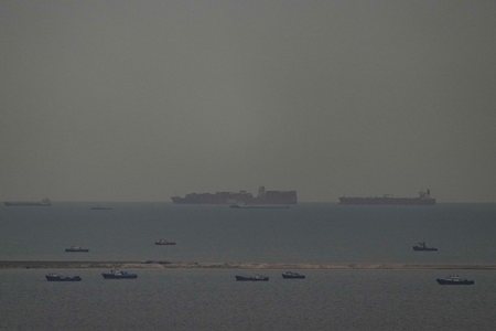
The latest crossings appear to have taken this alternative route, which passes through Iranian territorial waters. The United States and Iran announced a two-week ceasefire agreement on Tuesday evening that included the full opening of the Strait of Hormuz, a vital waterway for global oil supplies that has been almost completely closed since the outbreak of war on February 28 and is still under Iranian control. From March 1 to April 27, 307 ships carrying crude oil passed through the Strait, according to data from Kpler, the owner of the website MarineTraffic, a number that is down by almost 95% compared to peacetime.
Under normal circumstances, about 20% of crude oil and liquefied natural gas (LNG) destined for global markets passes through this narrow passage that connects the Gulf to the busiest maritime corridors.
Where are the "Tehran taxes" located?
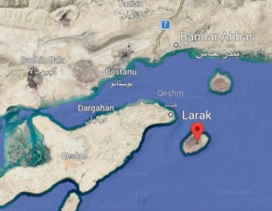
Larak Island, a small and relatively unknown piece of land in the Persian Gulf, has become one of the most critical geopolitical centers in the Middle East. It lies east of Qeshm and south of Hormuz, right at the narrowest point of the Strait of Hormuz, where one of the world's most important sea passages meets.
Its geographical location is not only important; it is also crucial. A large percentage of the world's oil trade passes through this point, making Larakh an important tool of control for Iran. It is not just an island, but a strategic lever of influence, allowing Tehran to influence energy flows and shape balances in the wider region.
Since the late 1980s, Larak has been used as an export station for Iranian oil, while also housing military installations that enhance its role as a navigational surveillance and control point. In recent years, its importance has increased further, as Iran is said to be implementing a system of designated sea lanes, through which ships pass under conditions set by Iranian authorities.
In this context, Larak has acquired an almost symbolic dimension in international maritime transport, as it is often described as a kind of "taxi" controlled by Tehran. Ships that choose to move within these corridors are under close surveillance, while passage is no longer taken for granted, but is linked to political and strategic calculations.
Despite its small size and limited population, Larak has a disproportionately high importance in the global energy and geopolitics landscape. At a time when tensions in the region directly affect markets and security of supply, this island is transforming from an unknown geographical feature into a central player in developments.


Lini një Përgjigje