


 Shkruar nga Pamfleti
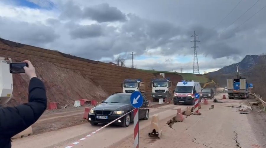
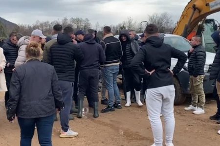
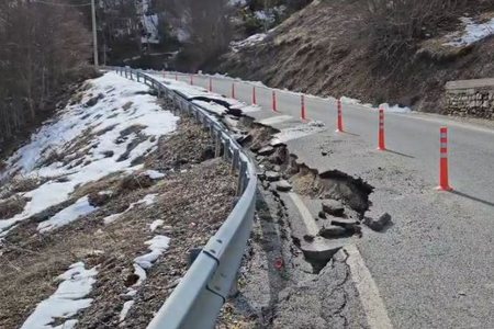
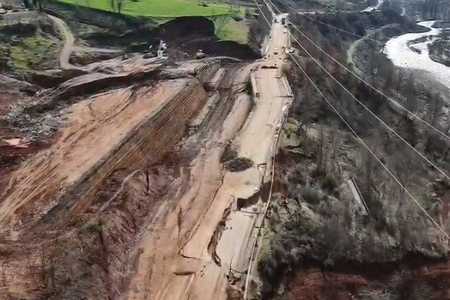
Massive landslides have been recorded in the Arrave i Gurrës area, disabling the road segment on this axis. From the scene, the director of the Geological Survey, Adrian Bylyku, provided details on the situation and the factors that led to this phenomenon.
Bylyku explained that a funnel-like shape has been created in the terrain structure, as a result of the landslide. According to him, the event is related to a combination of natural factors, where heavy rainfall in recent months has had a direct impact.
"A seasonal landslide has occurred, which like any landslide has several causes. The main element is related to the composition of the soil and the contribution of rainfall in the Arrave i Gurrës area," he told "News 24".
Bylyku emphasized that, according to available data, from December 2025 until now, the amount of precipitation has been about three times higher compared to the average of the last 10 years.
"It's a complex of factors, but the main one remains the oversaturation of the structure," he added, underlining that the waterlogged soil has lost its stability, which has led to the massive landslide.
Authorities are monitoring the situation on the ground, while it remains unclear when the damaged road segment can be fully restored.
Has the construction of Corridor VIII and erosion had an impact?
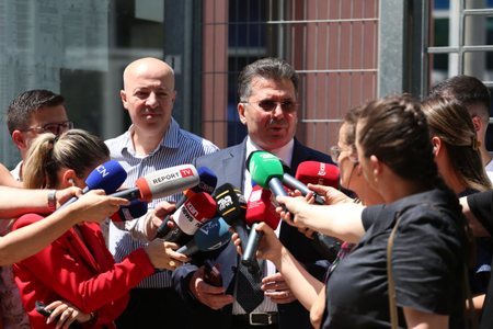
Adrian Bylyku: In the case of a landslide, there are several factors that influence it, but there is one factor that is the main one, as in this case, which is the water factor. And other factors from the composition of the soil, or even the interventions that have been made, must be taken into consideration. In this case, the geological service is making all the observations and it still takes time to get all the information. Geology is a multidisciplinary science and experts in the field are required. Without a doubt, with experts from the ARRSH and the company that has the cooperation, we are looking at all the options, the main thing is to determine the situation and give the right recommendations as soon as possible.
Were there any signs of danger, were there any warnings?
Adrian Bylyku: It is not involved in the project, I can say that from a historical point of view this is an area with landslide characteristics. From a monitoring point of view in recent periods the geological service has not been involved. I said that the area in question is problematic in terms of landslides in various fragments that have occurred here. This safety measure taken now is very important, the role of the geological service is that from this moment it has started to be involved and today we are looking at how we will mount the drilling probes. We have just started from a geological point of view and we will do our best for what concerns us and in relation to the other parts the thing is complex.


Lini një Përgjigje