


 Shkruar nga Pamfleti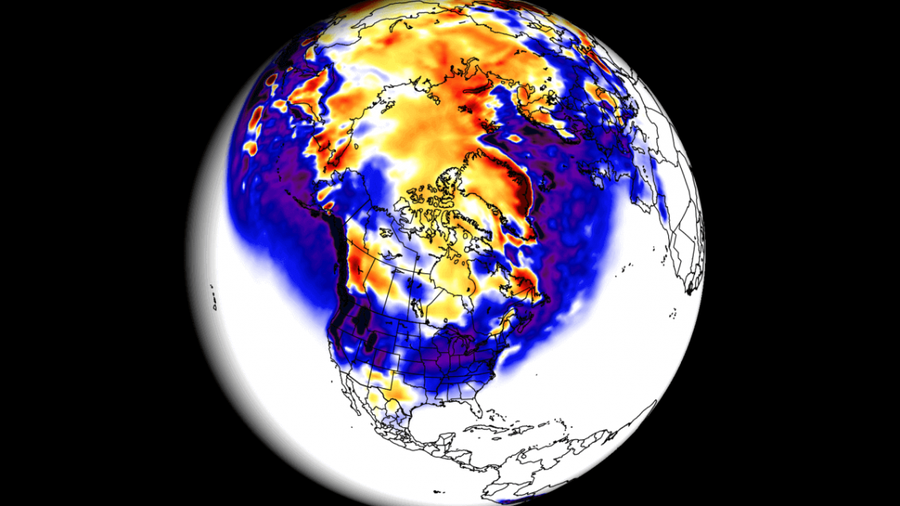
A growing El Nino event will be a major factor for the 2023/2024 winter season in the Northern Hemisphere, writes Severe Weather Europe.
There is a marked change in current patterns compared to last year, with trends emerging for dynamic weather patterns in the central and eastern United States and northern Europe. A growing El Nino event will be a major factor for the 2023/2024 winter season in the Northern Hemisphere, writes Severe Weather Europe. Looking first at the temperature, we can see an interesting cold signal over northern Europe.
There is also a colder signal in western Europe, while temperatures are above normal in the east in an average winter. This winter, there may be more precipitation in northwestern Scandinavia and parts of central and southeastern Europe. Western Europe is usually drier during the winter. It looks like the greatest potential for snow will be over and around the Alpine region, and towards the higher elevations of SE Europe.
And, of course, over the northwestern parts of Scandinavia, writes SWE.
Even if the models are 100 percent accurate, this does not mean that such weather conditions will last for three months in a row. They only suggest what weather patterns might look like most of the time. The ECMWF model is often called the most reliable model. But no long-term/seasonal forecast can be called "reliable". That's because we're only looking at trends and how weather patterns can evolve over a long period of time, writes Severe Weather.
The ECMWF winter pressure pattern forecast shows a typical El Nino weather pattern. We have an area of low pressure over the North Pacific and a band of low pressure anomalies over the southern US and northern Europe. ECMWF's monthly NAO forecast actually hints at negative trends in mid and late winter. This would increase the chances of a cold front in the eastern US and parts of Europe. Looking at the surface temperature forecast in Europe, we see that surface temperatures are mostly above normal across the continent. But there is a neutral zone over the northeastern parts of the continent.
In terms of rainfall forecast, we can see that Europe has a strong signal for above average rainfall. This increases the chance of snowfall mainly over the Alps region and Scandinavia. "Reading the pictures and descriptions can be a bit confusing. So, to simplify everything, here is what the first forecast offers for the winter season 2023/2024 in brief", they explain. Europe is expected to experience warmer than average temperatures across much of the western and central parts of the continent. Lower temperatures will be more pronounced in the northern and northeastern parts of the continent. This means that the main mode of circulation over Europe will be from north to south, meaning a flow from the north over Europe.
The possible snowfall scenarios in Central Europe will be related to the intensity of the northerly flow and some cold fronts that will descend from the north. "As for precipitation, more is expected in central and southern Europe. The snowfall forecast shows less snowfall in Europe, despite more precipitation overall, except at higher elevations," SWE writes.
Severe Weather Europe also analyzed the latest snowfall forecasts and trends for the whole winter. As with the general forecast, they also used the ECMWF model for the snowfall forecast. "First, looking at the average picture for Europe, we can see a poor snowfall forecast. Much of the continent is forecast to see less than normal snowfall, with the exception of parts of central Europe and Scandinavia," writes SWE. The December snowfall forecast shows that most of the continent will see no snowfall, except in the far north. This is probably related to the westerly flow over most of Europe.
Një pamje shumë e ndryshme mund të shihet në parashikimin e janarit, me potencialin e reshjeve të borës në rritje të fortë në shumicën e vendeve qendrore. Një rritje edhe më e fortë është e dukshme në shkurt. Më shumë reshje bore parashikohen në pjesën më të madhe të kontinentit, me përjashtim të pjesëve jugperëndimore dhe jugore.Sipas modelit UKMO, parashikimi për reshje bore është gjithashtu se do të jetë i dobët. Pjesa më e madhe e kontinentit parashikohet të ketë më pak se normalja e borës, me përjashtim të disa pjesëve qendrore dhe veriore. Parashikimi për muajin dhjetor është identik me modelin e parë, i cili, siç u tha, i jep këtij skenari një probabilitet më të lartë. Duke parë parashikimin e reshjeve të borës për muajin janar, nuk ka shumë përmirësim, përveç në disa pjesë të Evropës Qendrore dhe në veriun e largët. Në shkurt parashikohen më shumë reshje bore në pjesë të Evropës Qendrore dhe drejt verilindjes.








Lini një Përgjigje