


 Shkruar nga Pamfleti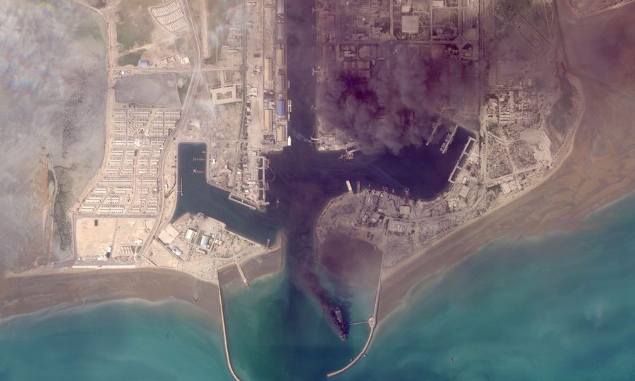
Ships are burning, columns of smoke rise above airports and damage to naval bases, in the first visual glimpse of the damage from the war...
The first satellite images released after the start of the Iran war show the scale of the destruction caused by the exchange of attacks between Israel, the US and Iran in the wider Middle East region.
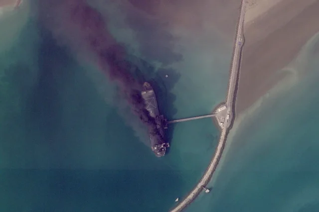
The images, in a first visual approach since the start of the war on February 28, show ships burning in the port of Bandar Abbas in Iran and destroyed buildings at a US military base in Bahrain.
The footage, recorded by Planet Labs PBC and other companies, provides previously unpublished data on damage to major facilities in the Persian Gulf and was published by the Associated Press, with a two-week delay.
As the company explained, the purpose of the delay is to prevent "hostile actors" from using this material for military operations.
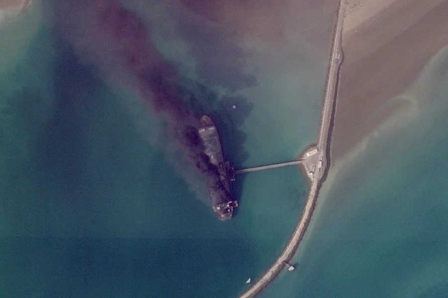
Burning ships in Bandar Abbas
The port of Bandar Abbas, one of Iran's main military enclaves along the strategic Strait of Hormuz, is shown in photos from March 2 with several ships engulfed in flames.
Attacks on Bahrain and the destruction of the Fifth Fleet
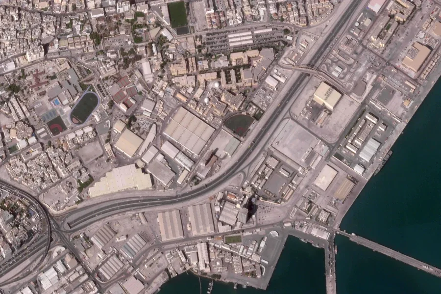
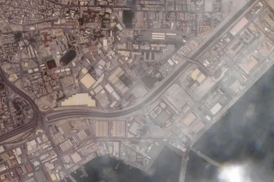
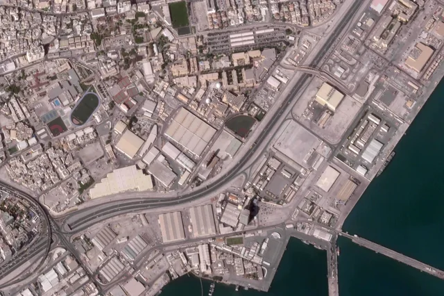
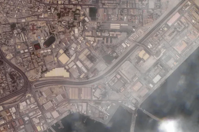
In Bahrain, the US Navy's Fifth Fleet base was photographed with a main building completely destroyed and two domes damaged, as captured on March 1. The attacks, which were attributed to Iranian missiles and drones, also hit nearby oil facilities.
Before the attack on February 25
After the attack
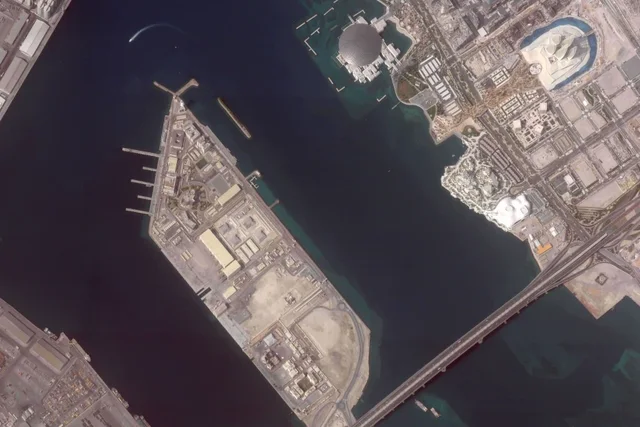
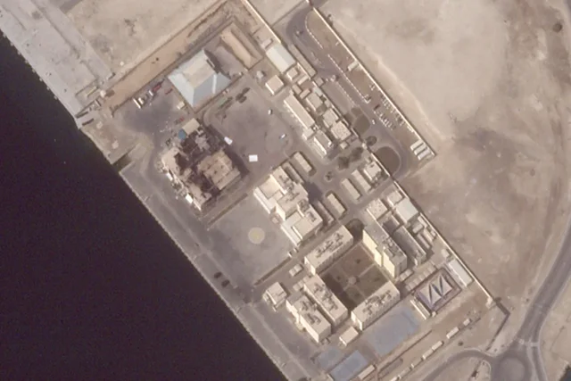
Damage to French naval base in Abu Dhabi
The consequences of the confrontation reached French military installations in the region.
On March 3, satellite imagery revealed damage to two large hangars at the Camp de la Paix base in Abu Dhabi, near Port Zayed and the Cultural District.
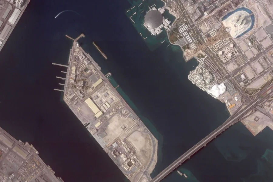
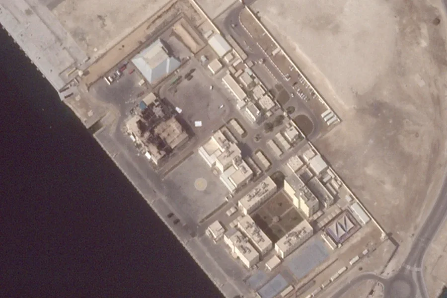
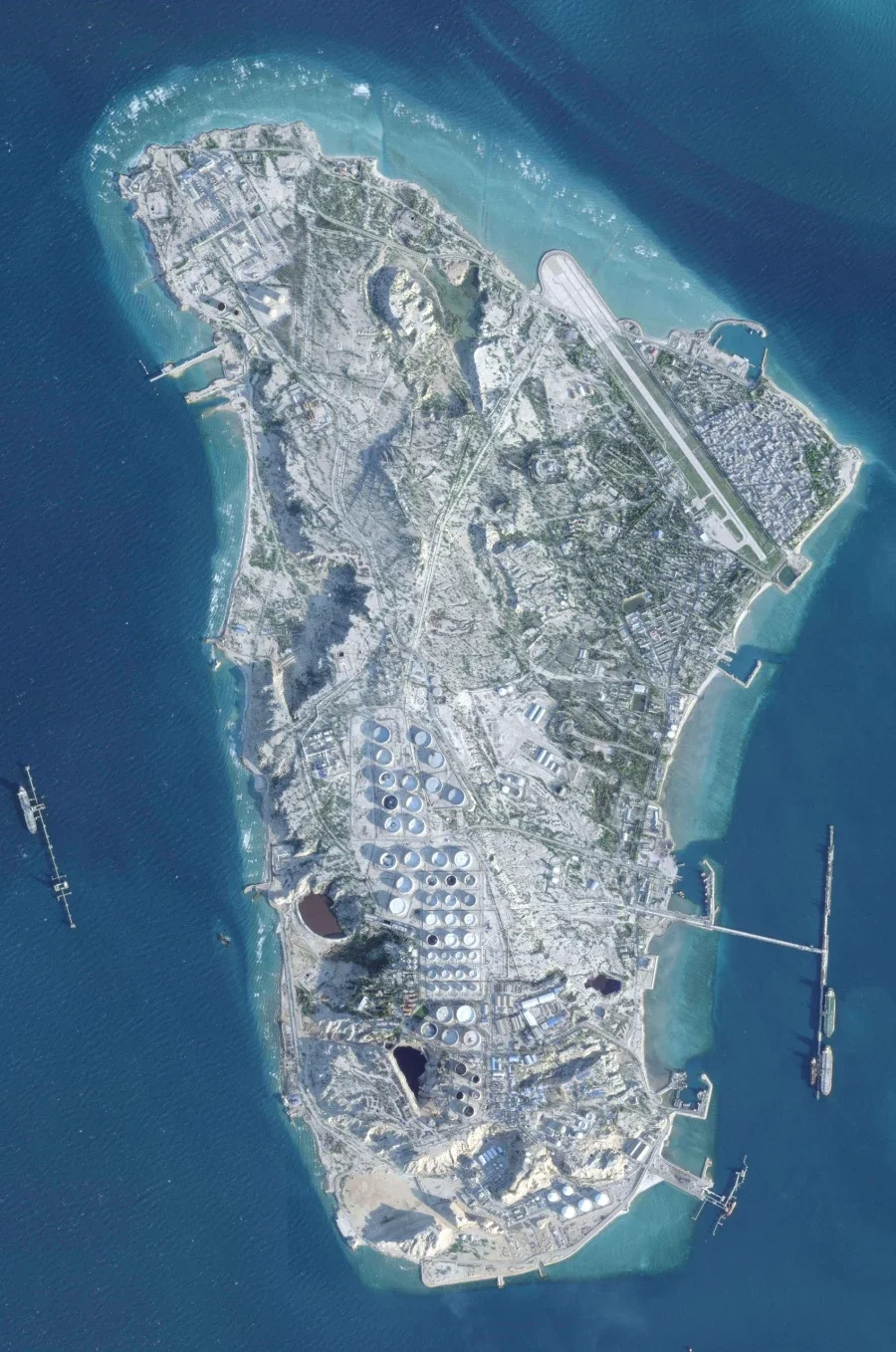
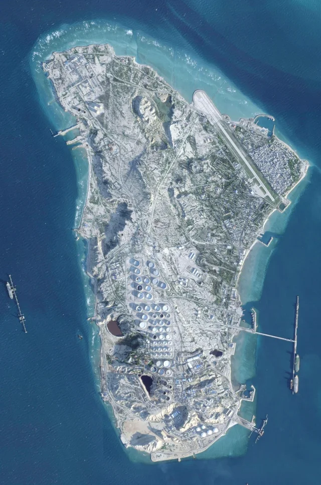
During another recent episode of the conflict, Al Udeid Air Base in Qatar was also targeted by Iranian missiles, losing a key radome for secure communications. Also released was a satellite image of Kharg Island in Iran, taken on February 26, 2026, before the start of the war and its bombing in the preceding days.
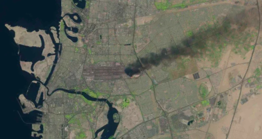
Fires at Gulf airports and ports
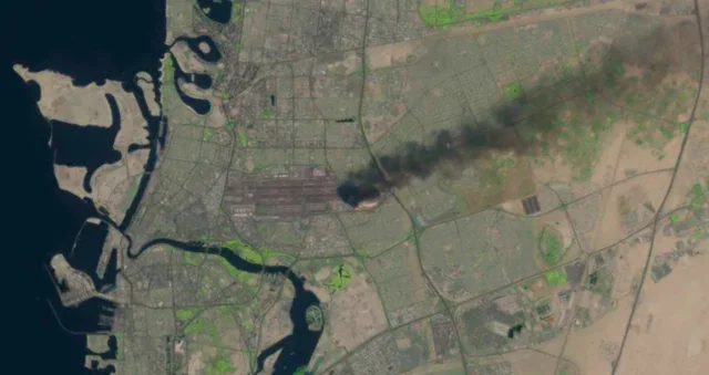
The United States Geological Survey's use of Landsat satellites has spotted large fires. One of the images on Monday showed a fire at Dubai International Airport, caused by an Iranian drone. A plume of black smoke rose above the terminal, which is considered the world's busiest international airport.







Lini një Përgjigje